The STEWARDS Web Mapping Application page has two main parts:
-
The Map displays the spatial framework you are working in. The initial Map dispalys
the conterminus United States with icons representing different research locations.
-
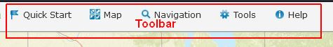
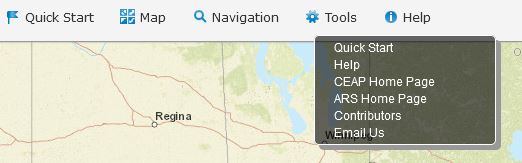
Along the top, a Toolbar for interacting with the application.
Each of the following options perform varying functions:
-
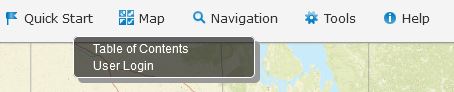
Map - Access to the Map Contents and User Login.
-
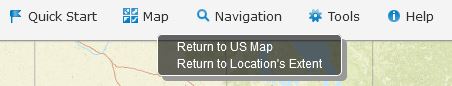
Navigation - Options used to navigate the map. Current action to navigate can be seen listed in the toolbar.
-
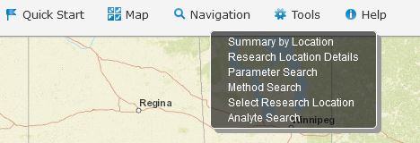
Tools - Various Tools that enable interaction with the STEWARDS database and drawing capabilities.
-
Help - Links to various help files associated with the application.
|